Wind and showers return this weekend as temperatures tumble
Wind and showers return this weekend as temperatures tumble
Forecasters predict a return to wet and gusty conditions across much of the UK this weekend, following a notably warm day earlier in the week. Wednesday’s peak of 26.6C in London marked the nation’s hottest early-April day in eight decades, but that warmth is now giving way to a more typical spring climate.
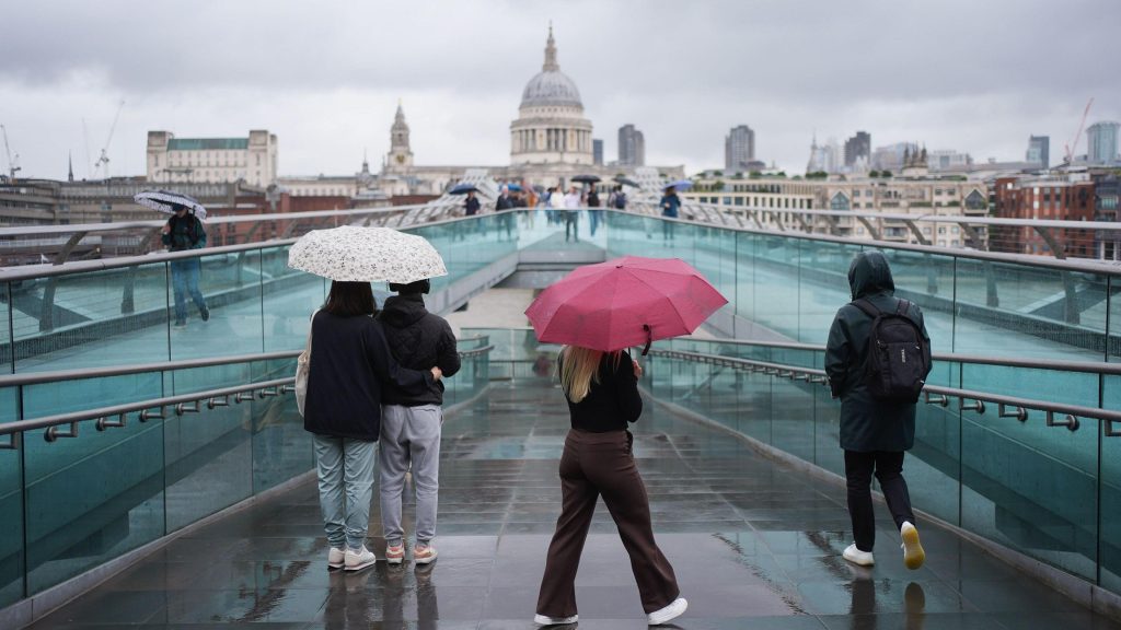
Low pressure systems are set to dominate, bringing fluctuating weather and cooler temperatures. While the weekend will feature a blend of sun and downpours, the most significant rainfall is expected in western regions, where thunderstorms and hail may accompany the showers. Areas like Scotland, Northern Ireland, northern England, and Wales could see heavier precipitation.
A cold front from the Atlantic will slow the movement of weather systems, allowing for intermittent rain and gusty winds, particularly along western coasts where gales may develop. These conditions will contribute to a sharper drop in temperatures, with highs ranging between 8 and 14C—close to the UK’s average for mid-April.
There is nothing strange or unusual about the cooler and more unsettled weather affecting the UK over the next few days. It is the temperatures we had earlier in the week that were out of the ordinary, in some cases more than 10C above the seasonal average.
Wednesday’s record-breaking warmth was driven by southerly winds from continental Europe, which briefly elevated temperatures to unseasonal levels. However, the shift to a westerly flow has brought back more typical spring patterns, with dry spells interspersed between showers.
Pollen levels will remain elevated in many parts of England, potentially exacerbating hayfever symptoms. While the weekend’s weather may feel slightly milder than Saturday, it will still be far from the record heat seen earlier in the week.
Spring is ‘fastest-warming’ season in the UK
Temperatures are expected to rise slightly during the first part of next week, though sporadic rain showers will persist. Whether this trend leads to a return to previous warmth remains uncertain, with no indication of a repeat of the extreme conditions seen a few days ago.
Is a ‘Super El Niño’ on the way and how will it affect the UK?
Weather patterns will continue to evolve as the weekend progresses, with the most widespread rain likely in the west and drier conditions further east. The transition to these typical spring conditions signals a shift from the unusual heat that gripped the nation earlier in April.